Georeference
Automatically
Our AI model scans your map and places control points.
All you have to do is review and accept them.
BACKED BY WORLD-RENOWNED INVESTORS


 77.xyz
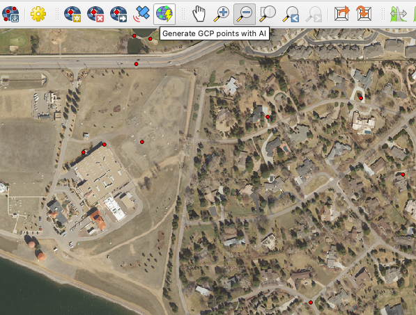
Aerial Imagery
Georeference your satellite or aerial imagery by just zooming into the general location of the image.
- Detects similar features
- Accounts for differences between images
- Allows you to move control points
Raster Maps
Our AI reads your map and finds relevant features the same way a human would.
- Finds interesctions, buildings, and railways
- Finds natural features like rivers and lakes
- Detects place names
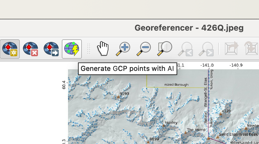
Built Into QGIS
Our AI is built directly into the QGIS georeferencer, no new workflow needed.
- Georeference as you always have, just faster
- Edit the AI generated control points as you see fit
- Georeference in a fraction of the time
Frequently asked questions
How can I try the AI Georeferencer?
Install the Bunting Labs AI Vectorizer QGIS plugin and open up the georeferencer. Our georeferencing buttons will appear in the toolbar.
Can I adjust the AI's ground control points?
Yes, the AI places preliminary ground control points. You can review them and either accept or adjust them as needed.
Will the AI work on my maps?
The free trial of our QGIS AI plugin comes with some test georeferencing capacity so you can see if it works for your maps.
Can I import my georeferenced maps into ArcGIS?
Yes, the QGIS georeferencer creates a GeoTIFF that you can download and import into ArcGIS.
Purpose-built for georeferencing
The solution for all of your maps.
Bunting is the easiest way to turn an image into geospatial data.
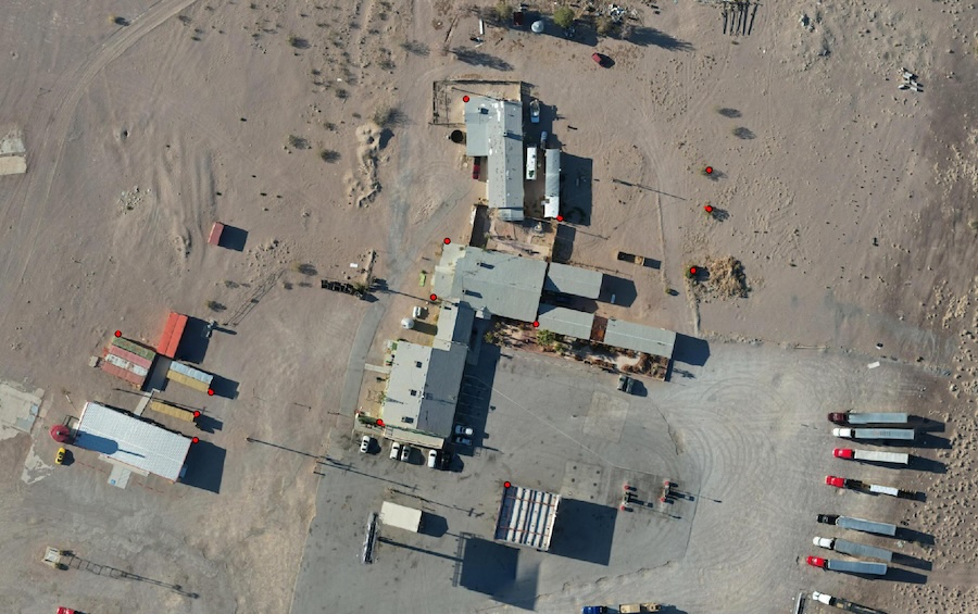
Aerial imagery
Georeference drone, aerial, or satellite imagery instantly.
Field maps
Your field teams can annotate paper maps and import them into QGIS.
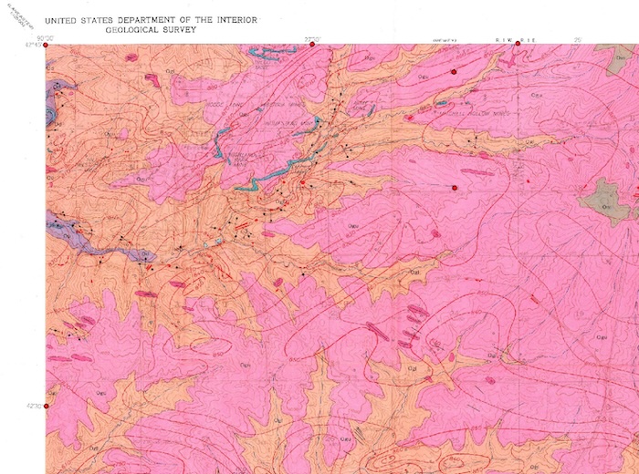
Geologic maps
Save time georeferencing the PDF maps in your project area.
City plans
Our ability to detect countless features lets the AI work on maps ranging from a single block to a whole city.