Map legal descriptions with AI
Bunting Labs is the modern solution to deed plotting. Using LLMs, our AI can read legal descriptions and output DXFs and Shapefiles, accelerating workflows in surveying, real estate, title insurance and urban planning.
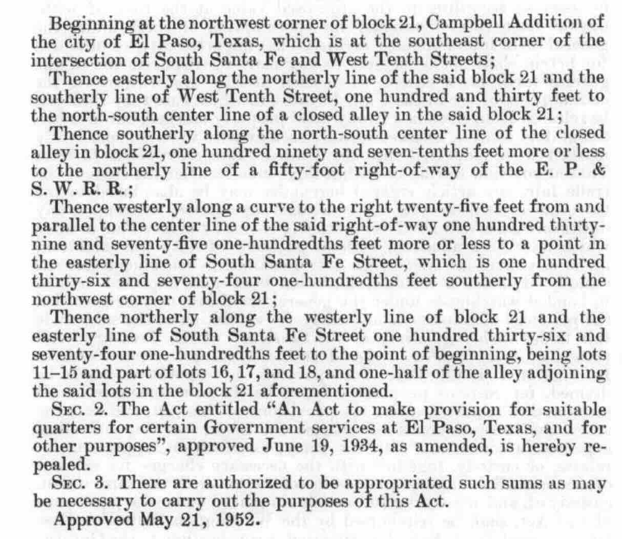
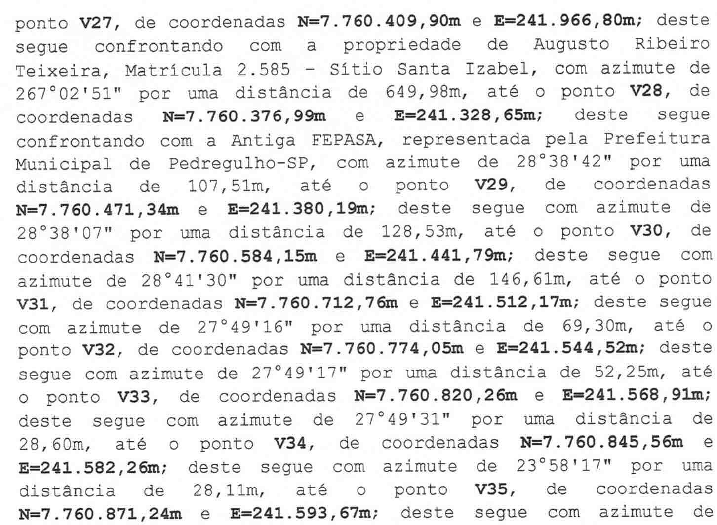
Read bearings and line calls from any PDF, in any format
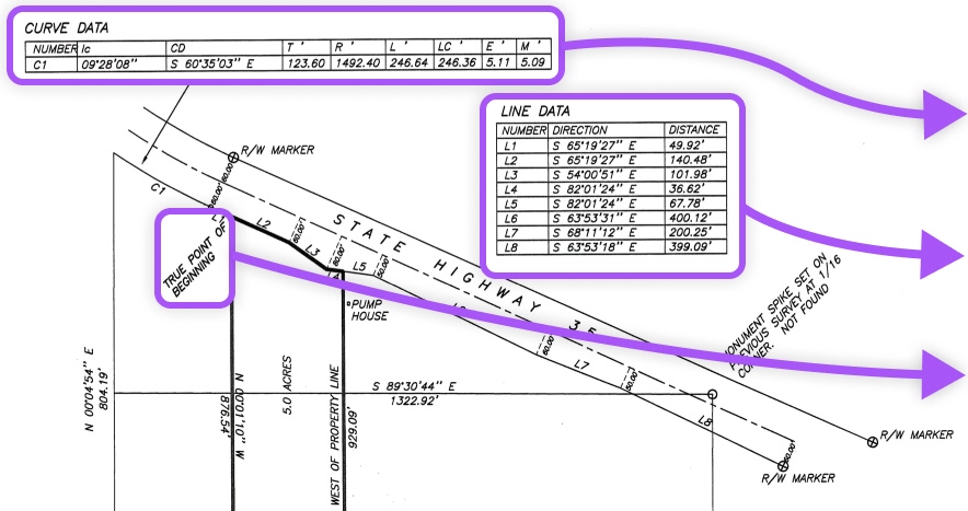
Using AI, we interpret survey calls, lines, points of beginning, tangent- and non-tangent curves from tables and paragraphs, turning it into structured output for GIS, CAD, and other relevant fields.
- Distinguishes point of beginning from commencement
- Reads line calls, tangent and non-tangent curves
- Notes reported survey area to check output accuracy
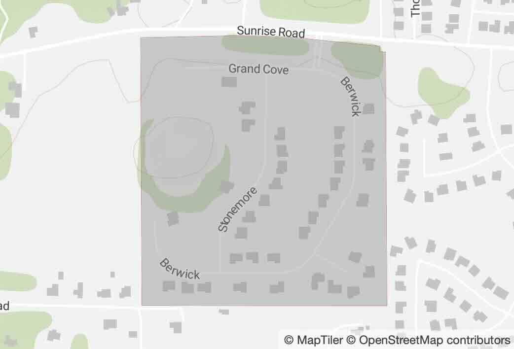
Generate polygons that are true to the original
Our AI generates polygons that accurately reflect the original survey data as much as possible.
- Handles any provided point of beginning and any output projection
- Interprets complex survey calls and curves
- Checks generated polygon area against document's surveyed area
Full transparency into every survey call
Our AI will cite the original document for each survey call and provide the text side-by-side so you can verify its accuracy.
- Hover over survey calls to see the original text
- Allows accuracy verification before downloading as a DXF or Shapefile


COMPATIBLE WITH

Try digitizing a deed for free:
- Point of Beginning: (..., ...)
- Number of Vertices: ...
- Distance to Close: ... meters (... feet)
- Document Geometry Area: ... hectares (... acres)
- Generated Geometry Area: ... hectares (... acres)
Frequently asked questions
Do I need to download any software?
No, you can upload and digitize a document, verify the accuracy, and download the geometry as a DXF entirely on our website.
What types of deeds can this digitize?
This can digitize documents that contain a single deed with no curves. Curves and multiple parcels are not supported, but are coming soon.
Can I use this instead of a surveyor?
No. Only licensed land surveyors can determine property boundaries or prepare and sign certified survey maps. This tool should only be used for visualizing the parcel geometry.
Can I download as a DXF?
Yes, you can download the converted legal description from our website as a DXF.
How can I verify the AI's accuracy?
After digitizing your document, our dashboard will preview the geometry on a map, tell you the area created, and document all of the text read and converted from the document.
Does this locate the point of beginning?
No, this requires user input for the point of beginning and only adds subsequent coordinates.