Create an Asset Map Easily.

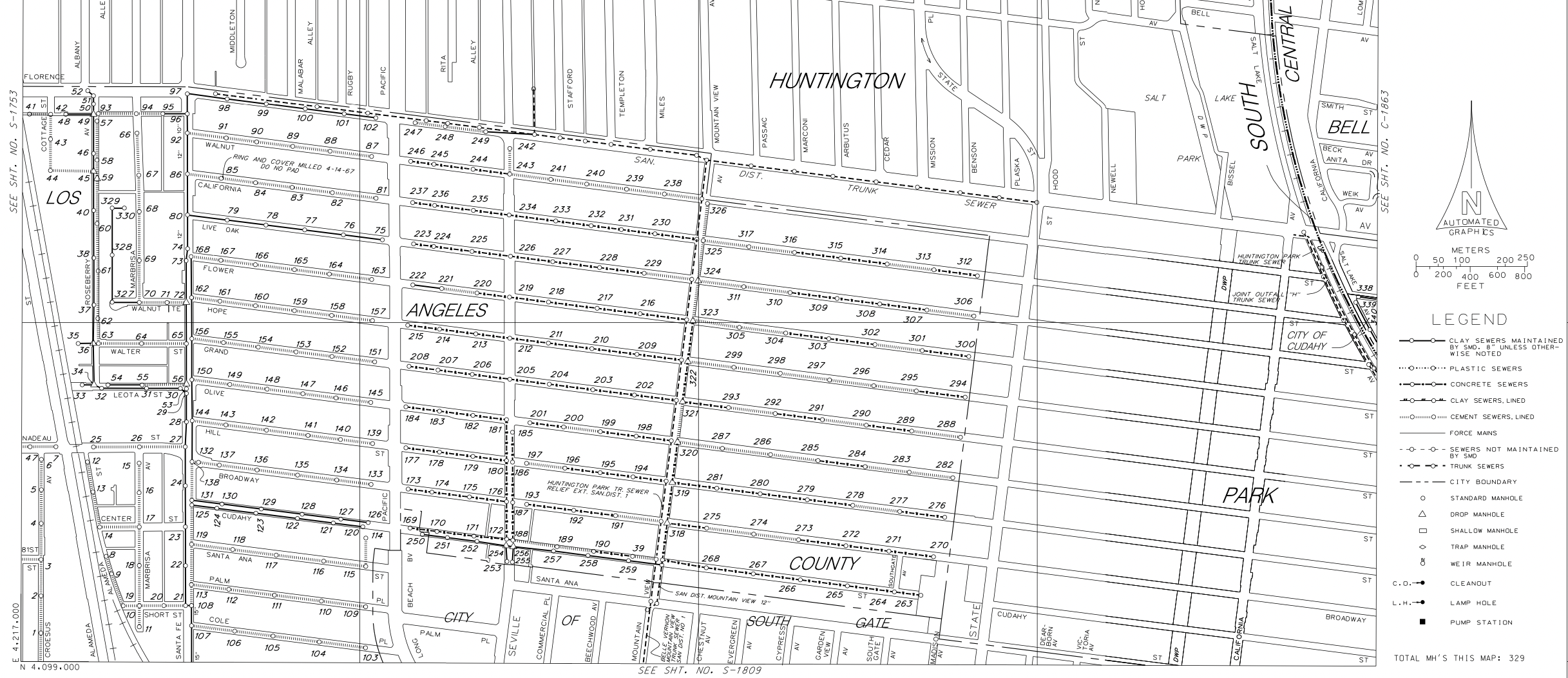
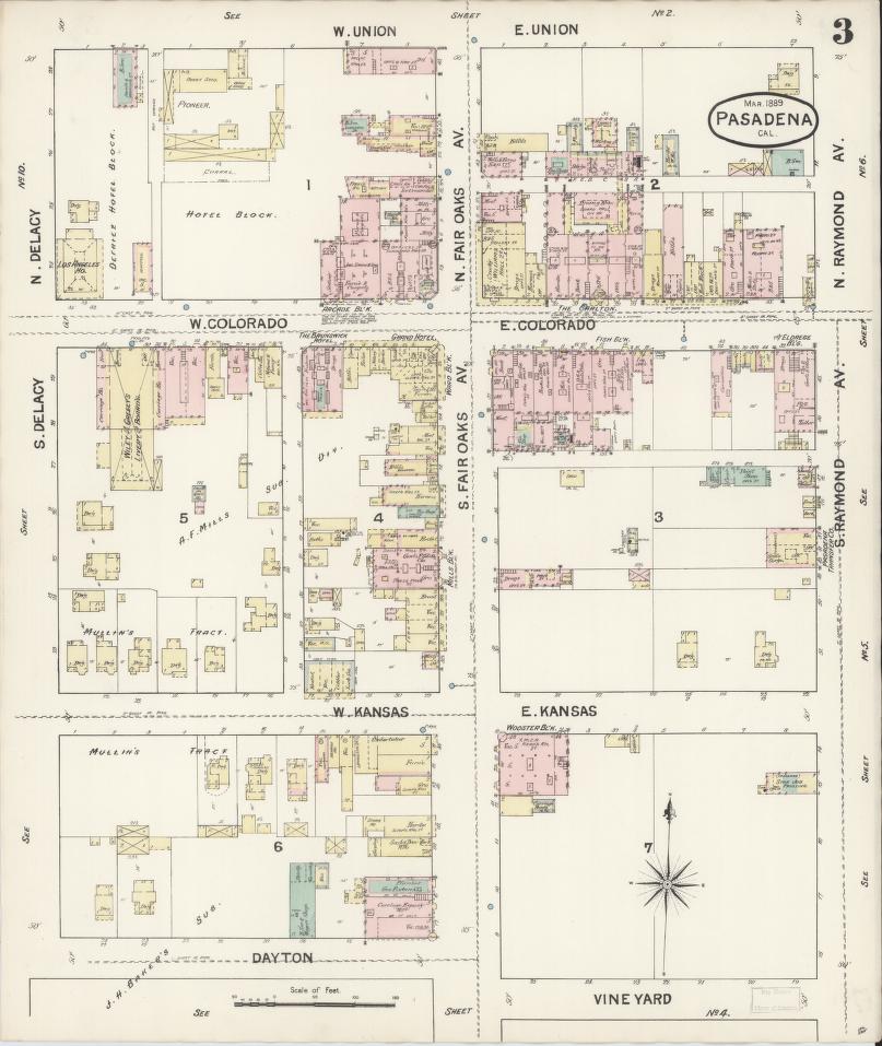
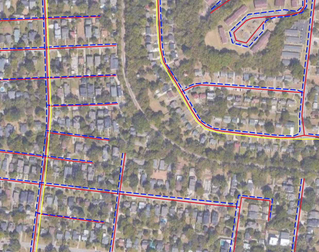
Our software cuts months and thousands of dollars out of large, manual asset mapping projects by automatically georeferencing and vectorizing as-built maps.

municipal asset map from scanned as-built

BACKED BY WORLD-RENOWNED INVESTORS

77.xyz

For Municipal, County, and Federal
GIS and Civil Engineering Teams

Government assets often predate CAD and GIS software, leaving many mapped on paper.
We can turn your paper maps into a digital asset map, saving your teams and constituents hours.

Fast Digitization

Georeference your maps, any age or condition. Extract any features you need: water, gas, sewer, electric, etc. If it's on the map, we will georeference and extract it.

Simple Process

Tell us what you'd like in an asset map, send us your documents, and we handle the rest: from digitization, to quality control, and delivery in any format you need.

Any Output Format

Receive the maps and assets in any format you need—a hosted tile-server or GeoTIFFs; Shapefiles or GeoJSONs. We can even host a mobile friendly web-map of your assets.

example as-built before creating an asset map

The Fastest Way From PDFs To An Asset Map

First, we georeference and extract features from your maps and manually verify their accuracy.

Then, we convert the outputs into any format you're looking for or create your custom web-map.

No GIS Experience Required

Whether you're a GIS manager with decades of experience or don't have a GIS at all, we can create a solution for you.

We can send GeoJSONs, DXFs, and GeoTIFFs for those who want full control, Shapefiles and hosted tile servers for ESRI shops, or even host an entire web portal with your assets designed exactly how you want it.

a raster utility map before digitization
IHE Delft logo

"This is a really great plugin that helps you trace vectors in a very easy and fast way", as featured in his YouTube review of our plugin.

Professor Hans van der Kwast

Professor Hans van der Kwast

Associate Professor of Open Science and Digital Innovation @ IHE Delft Institute for Water Education
Carto logo

"This is an absolutely perfect use of AI in geospatial. It takes a very manual and time-consuming task and passes that off to AI while still being able to have human intervention when needed. Amazing work!"

Matt Forrest

Matt Forrest

Field CTO @ Carto

Modernize your asset mapping

Turn your PDF and scanned maps into a digital asset map and save your GIS team, civil engineers, field crews, and constituents hours.

Get started