
When I talk to local governments, the #1 recurring problem is infrastructure documentation that is locked on paper or PDF. Libraries of scanned engineering drawings ("as-builts") hold critical information about the location and depth of utility lines but are nearly impossible to access in a filing cabinet.
When construction or emergency response teams need to know the position of gas, water, or electrical lines, they can require hours of thumbing through paper plans or ground radar scans to avoid dangerous utility strikes, which cost an average of $3,000 per strike.
It's confusing to navigate the cloud of ESRI, CAD, and GIS software, much of which goes unused by teams. Because of this, even GIS teams are surprised that automated software can now digitize, georeference, and transform collections of as-built PDFs into interactive maps.
Automated software can transform as-builts into online maps
Innovations in machine learning and geospatial data has made it possible to georeference and digitize complex as-built PDFs into traditional file formats that GIS teams are familiar with, like Shapefiles and GeoJSON.
By digitizing their archives, municipalities can gain a powerful tool for coordinating construction, responding to emergencies, and ultimately serving their communities more effectively at lower cost and risk. Unlocking the potential of as-builts may be easier than anticipated with today’s technology.
Hand-georeferencing doesn't cut it anymore
When considering how to digitize a library of as-builts (over 100), the debate boils down to digitizing automatically or hiring a team to digitize them manually. Both have pros and cons, but when you realize that digitizing manually is a mind-numbing process, repeated thousands of times, you often have very few volunteers for the project.
| Hand digitizing | Automatic | |
|---|---|---|
| Time Needed | 30 min/PDF | 2 min/PDF |
| Error | Unknown | ± 3 meters |
| Experience Required? | ESRI Professional | No experience needed |
An additional pain of outsourcing manual digitizing work is the humans doing it are often physically far away from the target as-built, losing context. This makes it difficult because road names change, buildings move, and they may be using outdated information.
How georeferencing paper PDF maps automatically works
Once an organization has high-quality scans of their paper as-builts (1200 DPI+ gives the best results for fieldworkers later), we can use advanced algorithms to georeference the scanned maps automatically. This, coupled with human quality checks, ensures that results are good enough for crews to reference when they're needed most.
Georeferencing paper maps automatically involves a few steps:
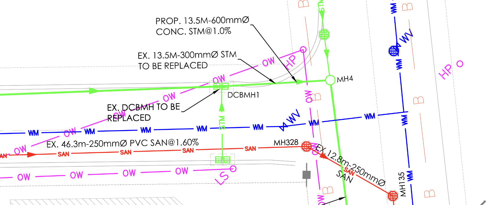
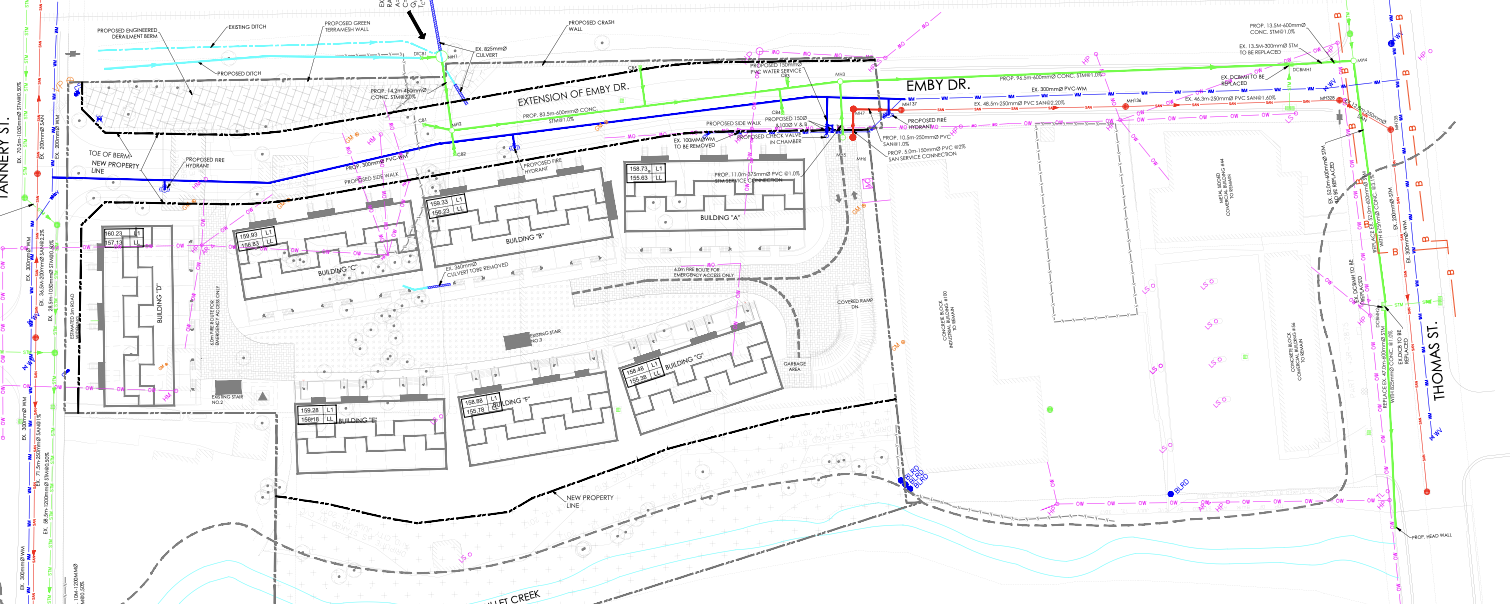
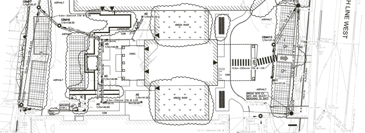
- Identifying features on the map that can be matched with geospatial data. Algorithms can detect building edges, road outlines, the presence of sidewalks, and even parcel boundaries in the scanned drawing to align with the real world.
- Handle map inconsistencies: PDFs differ drastically between sources, because every drafting engineer has their own style, much like an author has their own voice. Various map scales, rotations, missing features, incorrect text and symbols, changing highway number and road names can all contribute to difficult PDFs to digitize automatically. Our robust algorithms address these by being using machine learning to elevate performance to new levels.
- Quality control: We manually check every PDF that is digitized to be sure all of the relevant assets have been digitized and accurately georeferenced to within the client's acceptable margin of error (MoE). This typically gets assets to within 1-2 meters of the correct location, even in rural settings.
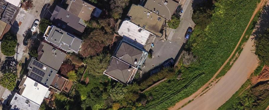
Our approach leverages advanced sources of geospatial data like satellite and aerial imagery, hand-marked maps from online databases, PLSS survey annotations, and coordinates in any CRS embedded in the PDF. The quantity of sources we use to create accurately digitized drawings sets Bunting Labs apart from other solutions.
Getting started with automatic georeferencing
Though these algorithms are very difficult to build, they present municipal governments a massive opportunity in digitizing the vast libraries of as-built drawings they have.
At Bunting Labs, we're building the premiere solution to automatically georeference and digitize 100s of as-builts without manual intervention. If you're interested in getting a consultation, register for an account or contact our sales team. If we can't be helpful, we'd happily provide advice as to more steps you can take.
If you thought this was interesting, you might also enjoy learning about digitizing survey plats automatically.