
Summary
As of July 2023, Bunting Labs provides the best alternative to Arcscan, combining highly accurate digitizing and automatic georeferencing. Scan2CAD provides reliable, descent vectorization for an affordable price. Finally, outsourcing can help free up time when you have a low volume of complicated maps that are not time sensitive.
Introduction
For GIS professionals who work with ESRI ArcGIS on a daily basis, converting raster images into vector layers is a daily struggle. The ArcScan toolbar was one tool for vectorizing images within the geographic information system. However, the future of ArcScan is unclear, as it’s no longer featured on ESRI’s product support page and is explained as an ArcMap, rather than an ArcGIS Pro, feature.
In this blog, we will look at different ways to convert raster images into vector layers without doing it yourself. These alternatives will balance speed, price, and accuracy so you can decide what’s best for your project and the specific documents you most often digitize.
Overview of ArcScan
Before diving into the alternatives, let's briefly review the ArcScan toolbar's capabilities and limitations. The ArcScan toolbar was a powerful tool for GIS, especially when dealing with raster-based image analysis and geoprocessing, with a lot of potential to transform the day-to-day work of GIS professionals. At its core, it was built to trace the center of raster lines, such as this example from ESRI’s website.

However, not only is it no longer readily available, but some users also found it to perform inconsistently. This inconsistency and unavailability is a major reason why people are looking for alternatives to ArcScan.
Alternatives to ArcScan
1. Bunting Labs Digitizer
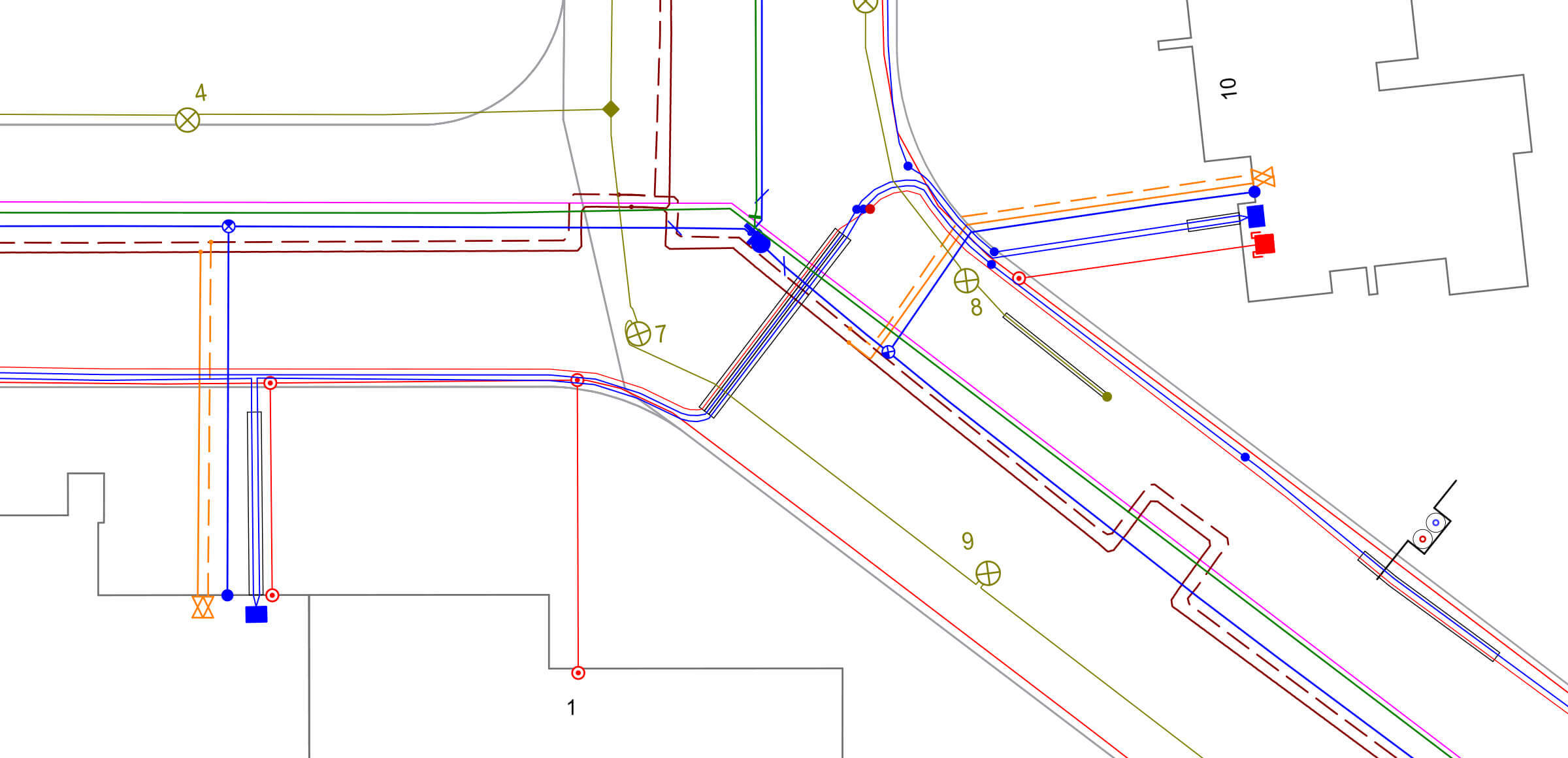
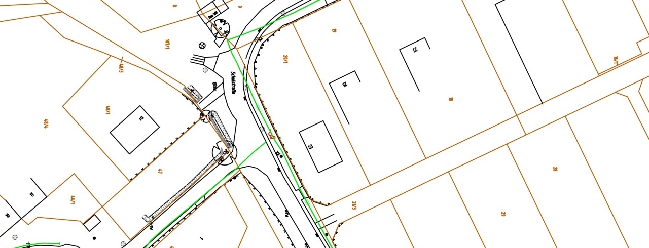
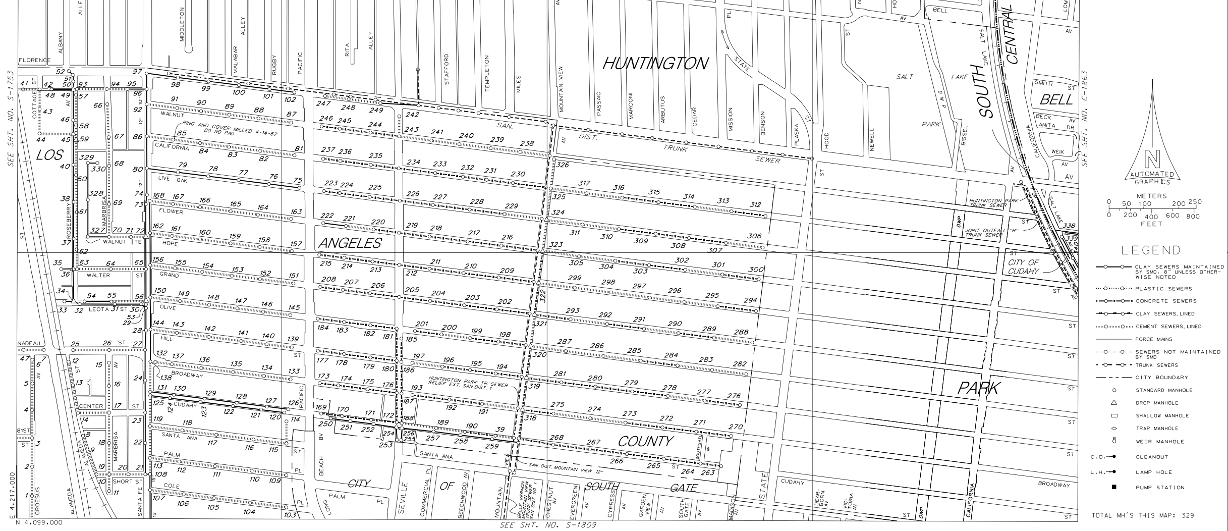
Bunting Labs map digitizer is purpose built to automatically georeference and generate features from maps. When it comes to maps for utility locating, such as the ones below, Bunting Labs digitizer is in a class of its own, with an ability to georeference to sub-meter accuracy and vectorize with 90% accuracy, all without any human intervention. All the user needs to do is upload their maps and then quality control the output—which can be received as DXF, GeoJSON, and/or Shapefile, and with the associated geotiff.
2. Online Converters for Vector PDFs: Fast and free (for some documents)
Vector PDFs are unique in their ease of digitizing. Because the maps already have vector information, there exist readily available tools to extract that vector information into a format usable in a geographic information system. If you search PDF to DXF, countless websites pop up that will make the conversion. You can then import a DXF into your geographic information system and georeference that vector layer. The downside to this is that anything that is a vector will be converted into lines, including letters, symbols, and labels, so your output may need significant cleaning up. It is a case-by-case basis to determine whether or not time spent cleaning up the vector conversion is less than just georeferencing raster and tracing a new vector layer. I’ve done both, but for larger, more elaborate maps, I often find myself converting to DXF and spending the time cleaning up the artifacts of the conversion.
Figuring out if a PDF is a vector PDF is straightforward. All you need to do is open it on your computer and zoom in as far as possible on a line. Even the highest quality raster PDFs will have jagged edges on the lines. Vector lines look perfectly high quality regardless of how close in you zoom. It is entirely possible to have both raster and vector data in a PDF. In this case, only the vector data will be converted to DXF through this method, so make sure that what you actually want from the document is a vector. I’ve seen maps which are very high quality raster and only the outline box of the map is vector.
3. Scan2CAD: Impressive Results, But Not Perfect
Scan2CAD is an impressive piece of software that, as the name implies, is designed to convert CAD drawings into CAD files (DXF and DWG). Fortunately, these files can be imported as a vector layer into GIS (though will still need to be georeferenced). Its output is great, but not perfect for all maps. Scan2CAD also does not georeference images, which means you will still need to go through the process of georeferencing the DXF as you would with a vector PDF conversion. Overall, this is a very similar option to vector PDF conversion in that for large projects it certainly is a great time-saver, but you are still stuck with some cleanup depending on your map and you still need to georeference.
4. Outsourcing Websites: Less Expensive than In-House, Still Expensive
When time is not a constraint, outsourcing this work to GIS professionals (on any number of platforms—Reddit, Fiverr, Upwork, etc.) can provide for a more cost-effective solution than having in-house professionals spend their time working on it. Typically these professionals can work with any geographic information system your project needs. In addition to being more cost-effective and reducing the burden of such monotonous work on in-house GIS professionals, Fiverr has the benefit of having a human oversee the project. This means that especially complicated projects which would stump an AI can be undertaken.
However, outsourcing is not without faults. Most notably, it still is very time consuming and costly. And, as with any work not done in-house, it would still be best to do QA/QC, so that time is not saved. While outsourcing may be helpful in some circumstances, augmenting your in-house teams with AI, either with Scan2CAD or Bunting Labs, results in faster, more economical outputs.
What Doesn't Work?
QGIS Raster to Vector Polygons: Exploring Built-in Solutions
For GIS professionals that have QGIS as their geographic information system of choice, there is a built-in tool available for raster-to-vector conversions. When I tested it on a utility map, it looked vaguely like it worked from a fully-zoomed out perspective, but when you zoom in it’s clear that the digitization did not work. While some vector lines were technically created from the raster cells, not only did it create polygons rather than lines, but it was also full of extra lines from various non-line parts of the map. I think this shows how difficult digitizing maps really is.
Photo Editors: Inkscape and Photopea
Free photo editors like Inkscape and Photopea, rather than tools meant for a geographic information system, are appealing because they are specifically designed to have features for raster-to-vector conversion in graphic design. However, no matter how hard I tried, I was unable to get the tools to create linework from raster images. The process for vectorizing an image of, say, a person is so different from the specific needs of vectorizing a map that it did not translate. The time spent fine-tuning the tools to each map and then cleaning up the image after would exceed manually digitizing any map.
Conclusion
Though ArcScan has served as a powerful tool for GIS image analysis and geoprocessing, perhaps ahead of its time, exploring alternative solutions can lead to new opportunities for growth and efficiency in digitizing raster cells. The alternatives mentioned in this blog, such as Bunting Labs's map digitization software, online converters, Scan2CAD, and even outsourcing to Fiverr, present compelling options for achieving accurate and efficient image analysis and geoprocessing without solely relying on the ArcScan toolbar for automatic vectorization. Depending on your needs, you may find Bunting Labs providing the best overall output for mapping, combining line vectorization and georeferencing, Scan2CAD providing very good vectorization-only results for a relatively affordable price, and outsourcing a reasonable option for small-volume, time-insensitive, complicated tasks. At the end of the day, the best option really does depend on the maps you’re trying to digitize. If you are curious about what might be best for you, please feel free to reach out to us and we’d be happy to help guide you through the process, even if it's not to Bunting Labs.